ギャラリー [アプリの紹介]
AREarthroidでみることができる、地球の様子をご覧下さい。
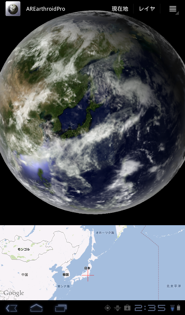
Android端末Acer A100 AREarthroidのバージョン1.2.6
雲の下に日本列島が見えています。
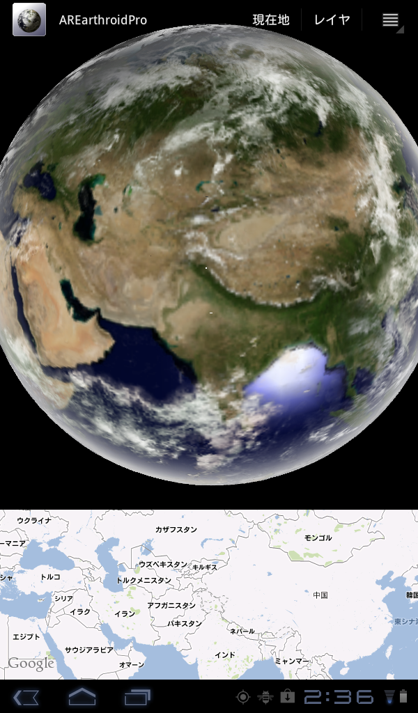
そのまま、マップをスライドさせ、地球を回していきます。
ちょうどインドのあたりまで来た様子がこちら。
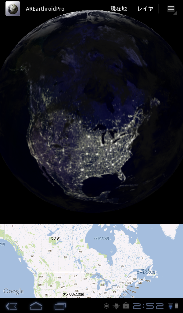
夜の部分までスライドさせると、街の明かりがみえてきます。
今日本は、昼間ですが、アメリカは夜ですね。
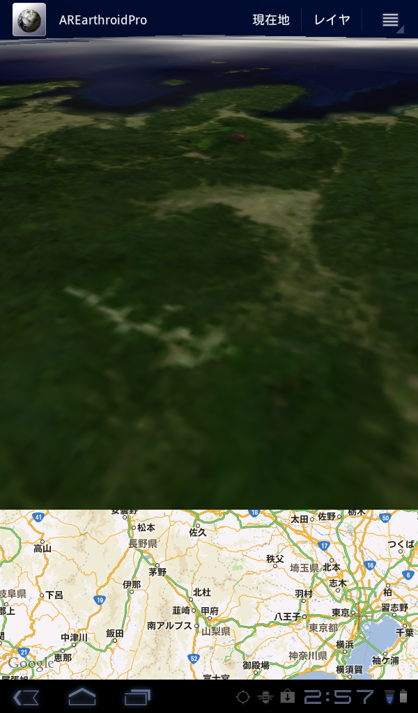
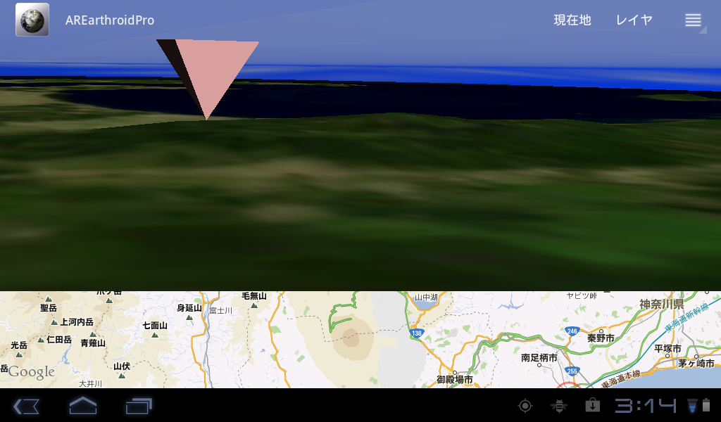
日本に戻って、下に降りてきました。長野県の方から富士山の方を見ています。
富士山頂から相模湾を望む。
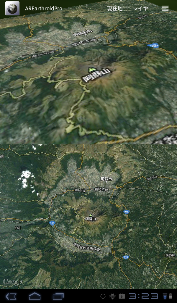
阿蘇山周辺を地図の衛星画像をマッピングしてみました。

Android端末Acer A100 AREarthroidのバージョン1.2.6
雲の下に日本列島が見えています。
そのまま、マップをスライドさせ、地球を回していきます。
ちょうどインドのあたりまで来た様子がこちら。
夜の部分までスライドさせると、街の明かりがみえてきます。
今日本は、昼間ですが、アメリカは夜ですね。
日本に戻って、下に降りてきました。長野県の方から富士山の方を見ています。
富士山頂から相模湾を望む。
阿蘇山周辺を地図の衛星画像をマッピングしてみました。
What is AREarthroid? [アプリの紹介]
An application that displays the earth (augmented reality) AR.
operates in more than android 2.2.
Ads will be displayed.
Ability
・The map displayed in 3D view and the Earth.
Orientation of the Earth in the 3D view, based on the direction of the terminal obtained from the sensor will be displayed in the "an AR".
Map and the Earth position is displayed, the value obtained from the GPS coordinates will be front and center.
This means that the orientation of the terrestrial magnet is displayed.
・The AR can be displayed to the synthesis of the Earth and the 3D image from the camera.
・You can display a "Amesh data."
・You can display the position of the satellite GPS.
One used for?
It does not matter if using, use the following method has been assumed.
・Use as a compass
If you put on the desk terminal, earth seen from above will be displayed. If you see like a familiar map, direction will be on top of the north terminal.
AREarthroid has the magnetic north correction function. From the direction information from the sensor, you will be able to know the "North" exactly.
Now, if you are in Tokyo own, Hokkaido appears near the top, that direction will be to the north.
.png)
・Use as a rough clock
AREarthroid calculate position of the sun, by the system date and time, and then displays. To use as a clock, but is absurd, if you know the approximate time. Sunset can also occur.
.png)
・Know the direction and distance of a location
"When Mount Fuji and direction? Or would appear from here, or there?"
If you think so AREarthroid comes into play.
Place the marker to the position of Mt. This is useful when you place a marker, is it you want to search.
Later, if "all round going around" with the terminal, you'll be able to find. Mount Fuji is located in the direction marker is displayed.
Distance, which appears when you tap the marker on the map. Large enough will be displayed in the 3D view is also nearby, is the approximate distance you can see.
.png)
・To know whether it is raining
"Rain. It going to rain Why is the rain came up to where?"
If AREarthroid, you can view the most recent data Amesh. Can be displayed to AR, whether it is raining in the direction of your progress you'll find good deals.
It is also possible to obtain the data for up to one hour before. You can play them continuously drag or flick the 3D view. Well you can see the movement of clouds.
Amesh data displayed only around japan.
.png)
・Know the state of reception of radio waves from GPS satellites
"But I can be in the GPS positioning in the room?"
In AREarthroid, acquires the location information using GPS. In addition to that, you also get status from the satellite radio receiver GPS. Based on the information obtained, and display it in the 3D view satellite GPS.
Will be that if you do appear in the 3D view satellite, radio has not been received. The exact positioning, without capturing four satellites will not be heard. If you do not see only three, positioning will not be able to.
.png)
・Look somehow
It is also fun just looking at the muzzles.
.png)
How to get
You can download from Google play.
AREarthroid free
AREarthroidPro
AREarthroidとは? [アプリの紹介]
AR(拡張現実)で地球を表示するandroid用アプリケーションです。
android 2.2以上で動作します。
AREarthroidは広告が表示されます。有料版のAREarthroidProは広告は表示されません。
できること
・地球を3Dビューと地図で表示します。
3Dビューでの地球の向きは、端末のセンサーから取得した方角にもとづき「AR的」に表示されます。
表示される位置は、GPSから取得した座標値が中心となります。
つまり、地球型の方位磁石が表示されることになります。
・カメラからの画像と3Dの地球を合成してAR的に表示することができます。
・「アメッシュデータ」を表示することができます。
・GPS衛星の位置を表示することができます。
何に使うもの?
どう使ってもかまいませんが、以下の使用方法が想定されています。
・方位磁石として使う
端末を机の上に置けば、上からみた地球が表示されます。見慣れた地図のように表示されれば、端末の上方向が北になります。
AREarthroidは、磁北補正機能を持っています。センサーからの方角情報から、正確に「北」を知ることができるでしょう。
端末を机の上に置かなくても(多少斜めでも)、方角を知る分には問題ありません。自分が今、東京に居るのであれば、北海道が上の方に表示されたら、その方角が北になります。
・大雑把な時計として使う
AREarthroidは太陽の位置を日付、時刻により計算し、表示しています。時計として使うのには無理がありますが、大体の時間ならわかります。夕焼けも発生します。
・ある場所の方角と距離を知る
「ここから富士山がみえるだろうか?方角としたら、こっちか?」
そう思ったらAREarthroidの出番です。
富士山の位置にマーカーを置きます。マーカーを置くときは、検索するのが便利です。
後は、端末を持って「ぐるっとひとまわり」すれば、見つけることができるでしょう。マーカーが表示されている方角に富士山はあります。
距離は、地図上のマーカーをタップすると表示されます。3Dビューでも近くにあるほど大きく表示されるので、大体の距離はわかります。
・雨が降っているかどうかを知る
「雨が降ってきそう。雨はどこまでやってきているのか?」
AREarthroidなら、最新のアメッシュデータを表示できます。しかもAR的に表示できるので、自分の進む方向に雨が降っているかどうかがよくわかるでしょう。
1時間前までのデータを取得することも可能です。3Dビューをドラッグまたはフリックして連続再生することができます。雲の動きがよくわかります。
・GPS衛星からの電波受信状況を知る
「部屋の中だけどGPSで測位できるかなぁ?」
AREarthroidでは、GPSを使った位置情報の取得を行います。それに加え、GPS衛星からの電波受信状況も取得します。取得した情報をもとに、GPS衛星を3Dビュー内に表示します。
3Dビューの中に衛星が表示されなければ、電波は届いていないことになります。正確な測位には、衛星を4つ捉えなくてはなりません。3つしか表示されていなければ、測位はできないでしょう。
・なんとなく眺める
単にぐりぐりして眺めているのも楽しいものです。
キャプチャ画像は開発時のものです。実際には広告が表示されます。AREarthroidProには広告は表示されません。
入手
Google playからダウンロードできます。
AREarthroid 無料版
AREarthroidPro 有料版
Copyright Atsushi Asai Google+朝井淳


